
This March, Margeaux Apple and I are focusing on one of my favorite tasks, cartography. I love maps. Maps are useful for orientation and for planning. We use a survey grade GPS purchased in 2013, and application software written on AutoCAD, BG-Map, purchased in 1993 and updated annually. Our graphics database, BG-Map communicates with our plant records database, BG-Base, purchased in 1988 and originally developed at the Arnold Arboretum of Harvard University by Kerry Walter of the Center for Plant Conservation.
March is a very good time to use GPS at the arboretum as satellites can more easily be detected by our Topcon Hyper SR receiver without a canopy of leaves on deciduous trees. In the office we use BG-Base to make a printout of woody plants in a particular area that have yet to be assigned coordinates. Maps are printed of an area to see if there are other physical features on the grounds that should be added or updated, and to note changes to existing woody plants or plant masses.
One reason to map the woody plants is that if they lose their labels their coordinates can be used to help identify which accession and individual “qualifier” they belong to. Qualifiers such as “A”, “B”, and “C” are used since a particular accession may have many plants that are planted in more than one area or bed. Note that coordinates on the lower right of plant records labels are in meters, but the coordinates recorded by the GPS are Northern Ohio State Plane in U.S. Survey Feet.

Once the day’s field work is accomplished the data is downloaded to a flash drive and then to BG-Map. Individual plant locations are inserted to the map and mass plantings get their outlines defined. Other features such as bed outlines, paths, benches, fences, walls, and structures are added to their respective layers in AutoCAD. Then the coordinates for the plants are converted to meters and transferred to the BG-Base PLANTS Table in both meters and in feet. Between 1979 and 2010 the arboretum’s grounds were surveyed on a metric grid system and we decided to convert the data in the computer rather than change all the coordinates on thousands of plant records labels.

The BG-Base PLANTS Table is edited to indicate how many labels should be made, lists are arranged by each inventory area, and the data is transferred and printed out. Plant records labels are printed on a DataCard embossing machine, purchased in 1997. The red anodized aluminum labels are then wired and hung on the south side of the tree or shrub and the plastic nursery tags are removed.
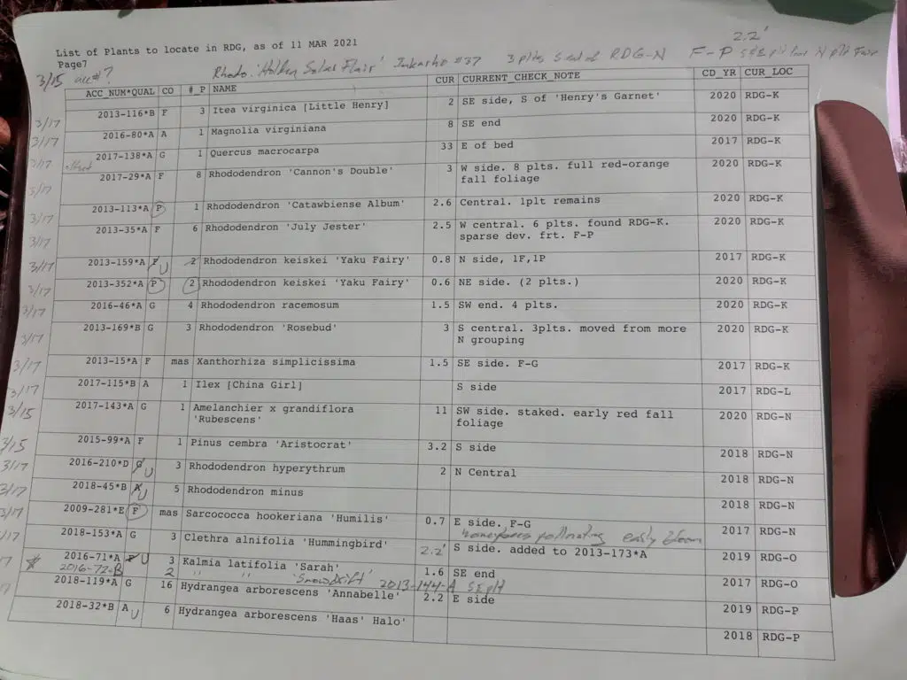
Not all areas have been mapped to include individual plant locations. Examples include Cleveland Botanical Garden, the David G. Leach Research Station, and various research collections. Once BG-Map and BG-Base have been updated, maps can be tailored to meet the needs of individual staff members such as Annie Rzepka, who recently made a request as she is planning on redesigning several planting beds in the Eliot and Linda Paine Rhododendron Discovery Garden.


Ethan Johnson
Plant Records Curator
Ethan learned to keep plant records while working for the Arnold Arboretum (1985-89) and Holden Arboretum (1981-82, ‘89-present) while volunteering for the International Dendrological Research Institute, Ohio Nursery and Landscape Association Plant Selection Committee, and the American Conifer Society. He was the point person when the American Association of Museums accredited Holden Arboretum as the sixth public garden in the U.S. as a museum in 2001, has curated the Storer Herbarium, mapped, labeled, and inventoried Holden Arboretum’s plant collection. Starting in 2015 Ethan has been responsible for keeping plant records at Cleveland Botanical Garden.


