Progress continues in our quest to map the plants here at the David G. Leach Research Station.
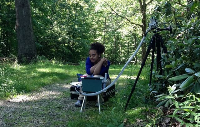
For those new to this plan, we are using a very sensitive and expensive (no you can’t borrow it yet), Leica FLX100 GPS antenna paired with a tablet to map the plant collections on an interactive web map.
This map will live on a new webpage dedicated to the Leach Research Station, with help from our colleagues in the marketing department. The webpage will work from your computer or smartphone-accessibility is key out in the field. Another cool benefit of mapping the collection…we can find the darn plants! Users can find plants on the property simply searching by accession number or name.
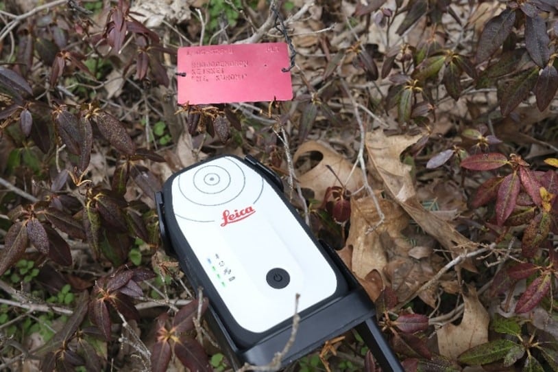
The GPS antenna can be set close to the center of the plant or mass, and the tablet is connected by bluetooth, allowing the user to be several feet away. This is often necessary when the plant tag is far from the plant center.
The GPS antenna is set to collect 10 sets of coordinates then averages them to get a final location. This improves accuracy.
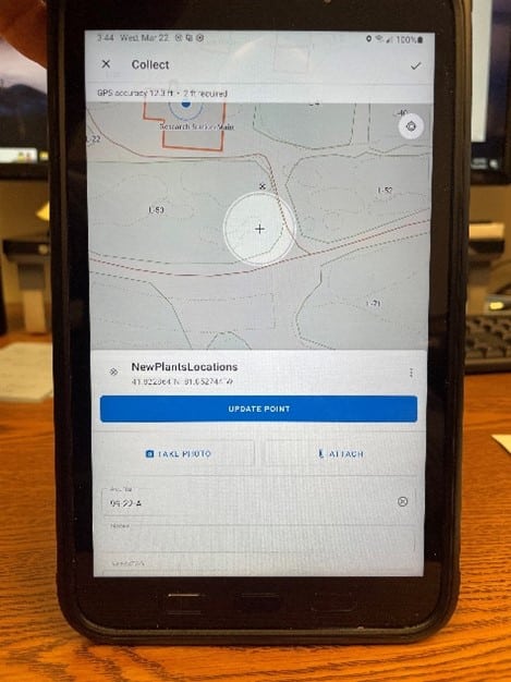
The Field Maps App can be configured quickly to collect features and data and import this immediately into your map on the cloud. The Apps can also be configured to work “offline” and will upload the new data when they get an internet connection.
The App also you to take a photo. This allowed us to take a photo of every tag during the data collection. Now we had another way to verify what had been collected, and we could verify accession numbers and names and fix errors.
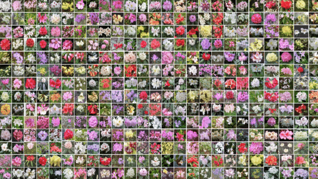
There are a number of large gardens and arboretums in the US who have introduced interactive maps so visitors can find specific plants on the grounds. Though the Leach station is not ordinarily open to the public, we wanted people to be able to “look into our data”, so to speak, and view what types of plants are here and what research is still taking place.
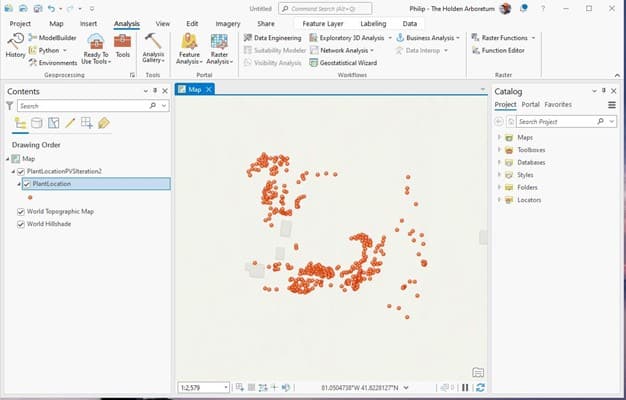
Recently, the Arboretum has delved into Geographic Information Systems(GIS), specifically Esri GIS services. This brings a ton of cool features and abilities to many of our projects. Not only is Esri the top dog in the GIS world, but they have a number of easy to build applications that can allow even inexperienced folks to create webmaps, collect data in the field, manage that data in the cloud, and display that data in webmaps, dashboards and other applications. Basically, any smartphone or tablet can connect to these services and when paired with better GPS antennas can be extremely accurate.
Out here we created a Field Maps collector application to map:
- Plants and Plant beds
- Roads and Fields
- Sprinklers, spigot points and other infrastructure

Joining Data with Location
One powerful feature in ArcGIS is the ability to “join” tables together using “like fields”. This helps us to quickly collect the GPS locations in the field. We load the accession number list into our collector app table so we can select the plant from a dropdown when collecting GPS coordinates. Later we join this in ArcGIS to an export from BG base (our plant database) that has all the attributes we want to attach to the feature. This allowed us to collect over 2000 plant locations out here in less than a month by only collecting location, accession number and other notes, rather than typing plant names or other horrifying levels of text into a tablet. This is how we created version-one of our webmap with pop ups showing data joined from BG Base. I’m sure other researchers at Holden can apply the GPS collect-join data” technique in some of their projects.
Importing data into BG Base
The next step was to get all of the plant location data into our main plant database. Raise your hand if you want to copy/ paste XY coordinate data into fields in BG for more than 2000 plants. We were able to create a spreadsheet with location coordinates, accession numbers, and check-note data and let our BG Base experts successfully import the list into BG!
In the future, we can update our map by exporting the plant data, including locations to a spreadsheet that can easily be mapped in GIS and shared to our webmap in the cloud. This is exactly how the National Arboretum updates their interactive plant collection maps.
So, at the time of this writing, we are matching the recently planted, untagged plants to their new accession numbers and updating BG Base with those coordinates. Once that is complete we will grab a final export to update our webmap!
We are looking at other cool ways to utilize ESRI ArcGIS out here at the station.
Here are a couple of easy-to-build applications:
- A Workforce app on a smartphone that allows someone to note a problem on the property and assign and notify another staff member to correct the problem-this is complete with photo and map coordinates.
- An App that allows us to collect locations of new plants in the fields before they are accessioned and track their progress.
- An App that can be used to collect plant inventory checks in the display areas. This data can be downloaded into spreadsheets and imported into BG Base, saving time and preventing carpal tunnel syndrome in plant records staff.
- We are going to create a separate, non-public webmap with as many BG Base attributes as possible that can be accessed by smartphone in the field. When staff are making crossing and selection decisions they can quickly access plant data on the spot.
It might sound like a lot of work to build all these Apps, but ArcGIS makes this process quick. Layers and basemaps can be shared to as many other webmaps as needed. An experienced user can create a new app and be out the door collecting data in less than an hour. We have several folks here at the Arboretum with GIS experience building apps and manipulating GIS data.
Thank you to everyone who has been assisting us with this project!

Phil Sturm
Data and Mapping Intern
Phil Sturm is currently the Data and Mapping intern at the Leach Research Station. Prior to moving to Ohio in May 2022, he was the crime analyst for the Harrisonburg Police Department in Virginia. Phil graduated from James Madison University with a Bachelors in Geographic Science, concentrating in GIS and Environmental Sustainability. He is a photographer and licensed drone pilot.
Here’s more to explore
November 29, 2023
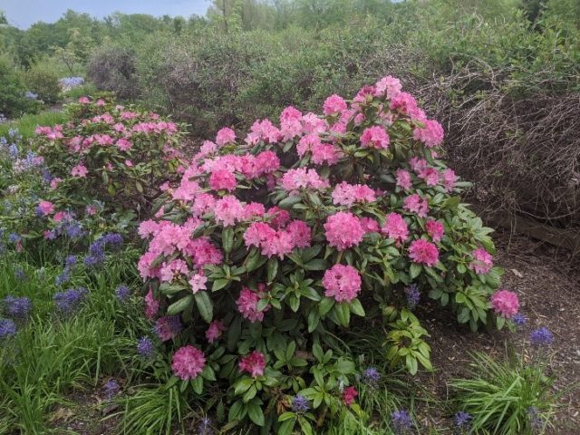
Rhododendron minus: A colorful mystery wrapped in a riddle
By Juliana S. Medeiros, PhD, Plant Biologist
Rhododendron minus is a woody evergreen shrub native to the southeastern United States, with a range that extends from North Carolina and Tennessee south into Georgia and Alabama. Across this... more
November 2, 2023
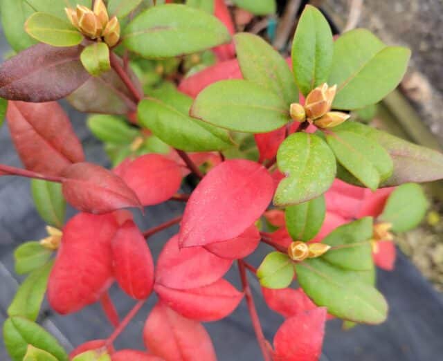
The Colors of Rhododendron’s Fall Foliage
By Sharon Halkovics, Research Specialist
Plant lovers are aware of the vibrant, showy flowers Rhododendron exhibit in spring. But did you know that some rhododendrons can display subtle yet colorful foliage that is worth taking... more
August 11, 2023
Fulbright Scholar Dr. Shweta Basnett to speak on Rhododendron pollinators
By Juliana S. Medeiros, PhD, Plant Biologist
Visiting Fulbright Scholar Dr. Shweta Basnett will hold lecture to highlight global diversity of Rhododendron pollinators and sensitivity to climate change. Dr. Shweta Basnett, Fulbright Scholar, University of Maryland, will... more
March 24, 2023
The Challenges of Rhododendron Research
By Sharon Halkovics, Research Specialist
Rhododendrons are loved by many gardeners for their bright, kaleidoscopic spring flowers. They are special for many reasons, including rhododendron being one of the most species-rich genus of woody flowering... more
January 6, 2023
From horticultural hero to cancer cure, what research has your Rhododendron done today?
By Juliana S. Medeiros, PhD, Plant Biologist
Your Rhododendrons are probably looking a little sad right now, amidst the cold wind and snows of January. They are probably drooping their leaves, maybe they have lost their beautiful... more
June 7, 2022
Rhododendrons in Bloom
By Sommer Tolan , Horticulturist
It’s interesting to observe the variation in rhododendron and azalea bloom times from year to year. Especially here in Ohio, where we’re not sure if snow or rain will be... more

August 14, 2020
Exploring the Rhododendron Research Network (R-RN)
The Rhododendron Research Network (R-RN) was founded at Holden in 2017 to increase collaboration and dissemination of Rhododendron research, to connect scientists with each other and with plant enthusiasts from... more
May 15, 2020
How genus Rhododendron became my favorite plant species
By Juliana S. Medeiros, PhD, Plant Biologist
As a plant scientist I am often asked the question, “What is your favorite plant species?” The truth is, I can’t pick just one. What I love about plants is... more
April 12, 2024
It’s Poppin’: April 12th
By Alexandra Faidiga, Plant Recorder
It has been an unforgettable week for northeast Ohio! Whether you were downtown or in the suburbs on Monday afternoon, at 3:13pm we were all gazing skyward to witness the... more